|
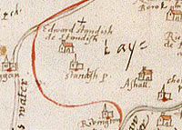
 This
map of Lancashire was made in about 1590 for Lord Burghley
who was Queen Elizabeth I's chief advisor. It shows
where all the main Roman Catholic families lived in
the county. In 1588 the Catholic King of Spain had tried
to invade England (the Spanish Armada). Elizabeth was
frightened that the Roman Catholics living in England
might join with the Spanish invaders to fight against
her, so she wanted to know where they all lived. This
map of Lancashire was made in about 1590 for Lord Burghley
who was Queen Elizabeth I's chief advisor. It shows
where all the main Roman Catholic families lived in
the county. In 1588 the Catholic King of Spain had tried
to invade England (the Spanish Armada). Elizabeth was
frightened that the Roman Catholics living in England
might join with the Spanish invaders to fight against
her, so she wanted to know where they all lived.
If you look
carefully you can see many of the houses have red marks
on them and the names of the owners written next to
them - these are where Roman Catholics lived. This map
helps us to understand just how important religion was
in Tudor times.


|