|
Exploration
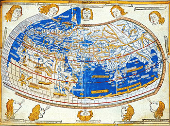
Click
on the hotspots on the map above to enlarge portions
of it. Can you recognise the shapes of countries
that you know from modern maps of the world? Which parts
of the world does this map show most accurately? Why
do you think this might be?
With
your partner, discuss how sailors involved in the voyages
of exploration in the 16th and 17th centuries would
have benefited from having maps and charts based on
measurement
as in Ptolemy's map,
rather than the older 'pictorial' system where the most
important feature was shown largest.
|