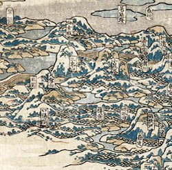
This
type of map is known as a perspective map. It shows
the country in two-dimensional form, and features like
mountains and islands seem to stand up.
The
famous Japanese artist Hokusai created this map of China
in 1840. It was made in the days before planes and space
travel, so how did the artist get the necessary 'view'
to be able to draw such a map?
It
is worth noting that Hokuasi never actually visited
China himself. However, he does seem to have had a good
sense of humour for he signed his map 'Manji, the old
man mad about drawing aged 81'!

|