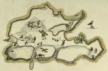
*
*
*
* Home * Topic menu * Back
Mapping History
*
Europe Pre 1914*  
*
* Reveal the answer
Mapping History
 
*
*

Map: Falkland Islands, 1768

Falkland Islands 1798


This map was drawn by Thomas Boutflower. He was the purser on the ship HMS Carcass, and not a professional cartographer.

Look at the map and decide which of the following you think shows this:


the colouring
the distorted shape of the coast
the fact that south is at the top of the map
the size of the map


Check your answers by clicking here:

Answer answer


*
 
*
Back / Topic menu / Home